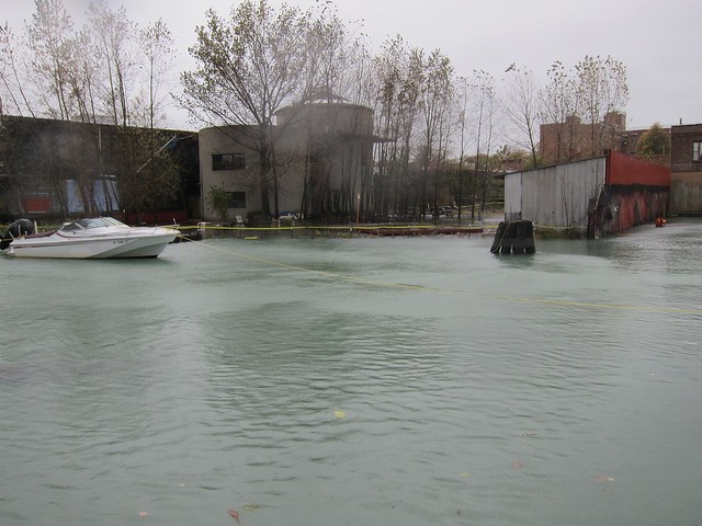
Canal at Carroll Street during Sandy (photo credit: Margaret Maugenest)

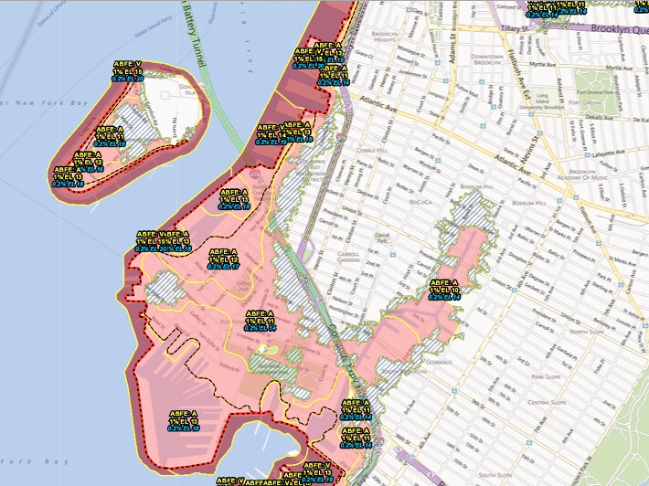
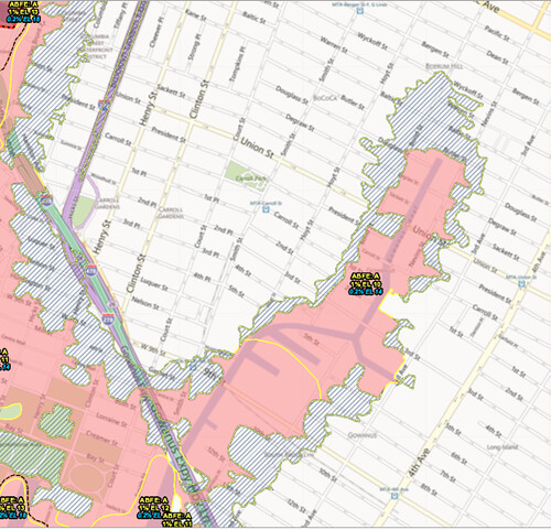
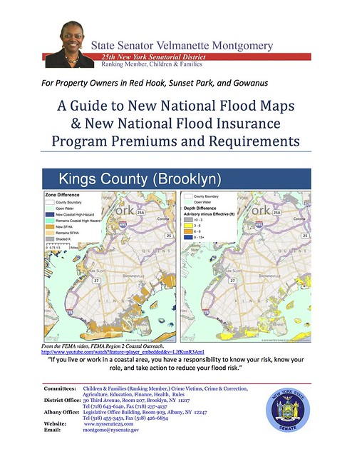
FEMA Advisory Base Flood Elevations for Gowanus And Red Hook
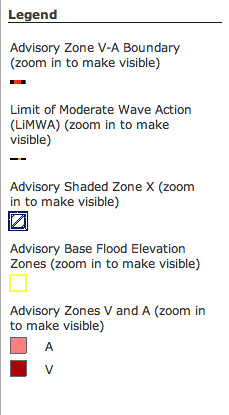
Just recently, FEMA has completed and added the ABFE section specifically pertaining to Gowanus and Red Hook. (You can access the section here)
New York's ABFEs are advisory now, but eventually, the information will be used to update the official FEMA Flood Insurance Rate Map. When the agency does include it in the next 1-2 years, insurance premiums in flood prone areas will go up significantly.
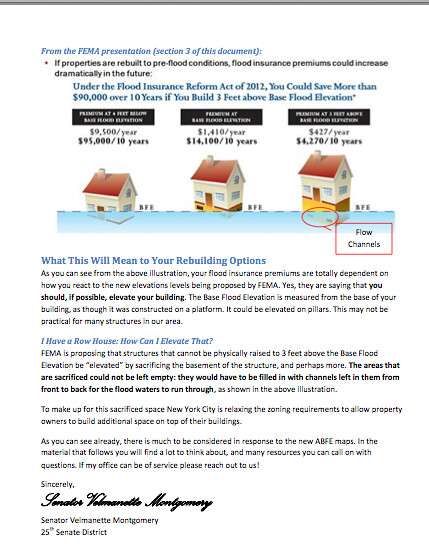
According to FEMA, if your property is in the redefined Zone A, it should be raised by 3 feet above the Base Flood elevation. Otherwise, your insurance premiums will go up. "Elevating" can be accomplished by rebuilding on stilts or, by sacrificing the cellar/basement of an existing home.
To make up for the space, New York City will relax zoning requirements and allow property owners to build additional space on their building.
State Senator Velmanette Montgomery would like to make her Red Hook, Gowanus, and Sunset Park constituents aware of all this new information and of all the new regulations. Her office just published a guide, part of which you can see below. You can also access it on her website here.
"As you can see, there is much to be considered in response to the ABFE maps" State Senator Montgomery writes. " If my office can be of service please reach out to us!"
New York's ABFEs are advisory now, but eventually, the information will be used to update the official FEMA Flood Insurance Rate Map. When the agency does include it in the next 1-2 years, insurance premiums in flood prone areas will go up significantly.
According to FEMA, if your property is in the redefined Zone A, it should be raised by 3 feet above the Base Flood elevation. Otherwise, your insurance premiums will go up. "Elevating" can be accomplished by rebuilding on stilts or, by sacrificing the cellar/basement of an existing home.
To make up for the space, New York City will relax zoning requirements and allow property owners to build additional space on their building.
State Senator Velmanette Montgomery would like to make her Red Hook, Gowanus, and Sunset Park constituents aware of all this new information and of all the new regulations. Her office just published a guide, part of which you can see below. You can also access it on her website here.
"As you can see, there is much to be considered in response to the ABFE maps" State Senator Montgomery writes. " If my office can be of service please reach out to us!"