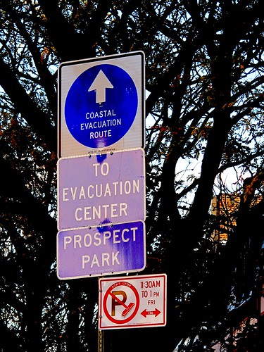
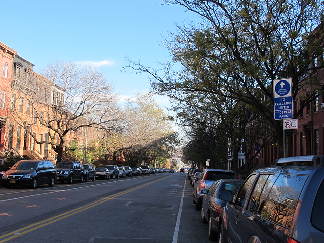
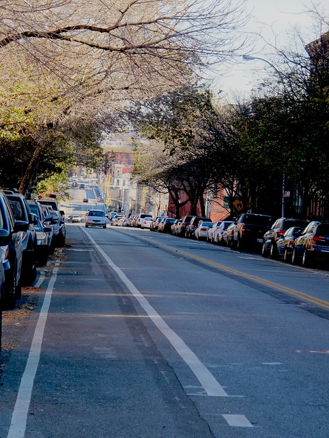
Evacuation Route out of Carroll Gardens led local residents along Third Street, over the Third Street Bridge and across the Gowanus Canal.
In other words, Carroll Gardeners and Gowanus residents who were under mandatory evacuation orders and needed to head towards John Jay High School on 7th Avenue, the closest shelter, had to drive through a low-lying Zone A area that floods every time there is a heavy rain.
Predictably, during Irene, the Evacuation Route flooded.
After reading my post, our elected officials took note and alerted NYC's Office Of Emergency Management (OEM) of this problem. State Senator Daniel Squadron, Assemblywoman Joan Millman, Brooklyn Borough President Marty Markowitz, and Councilman Brad Lander, in a letter to OEM, wrote:
"As indicated by the signs posted in the area, the "Coastal Evacuation Route" (CER) is via the Zone A area of Third Street, over the Gowanus Canal. This is problematic because the low-lying streets surrounding the Gowanus Canal are prone to flooding, even during moderate rain storms.Unfortunately, nothing was ever done to remedy the situation. So, when Hurricane Sandy hit New York City last week, local residents were still expected to drive through a flood zone and over the Gowanus Canal, an EPA Superfund site.
Our top priority is getting people out of harm’s way as safely and efficiently as possible. To that end, we are writing to request that your office reevaluate the evacuation route for this area and provide information as to possible alternative routes.We look forward to hearing from you and please let us know if we can be helpful in resolving this matter of concern to our constituents."
Just take a look at the flooding at Third Street at the intersection of Bond Street during this last storm.

(photo credit: Triade Samaras)
Carroll Gardens/ Gowanus Coastal Evacuation Route under water
View of Third Street at Bond Street during Hurricane Sandy
As far as finding alternate routes, that may be a difficult task. Most of the local roads leading out of the neighborhood are congested on a regular day. In the case of a stronger hurricane with evacuation of Flood Zones A and B, traffic would probably come to a stand still. Add to this the fact that traffic will increase along that stretch of Third Street once the Gowanus Whole Foods will open next year, it may become impossible to get to higher ground.
And let's not even talk about the extra residents who will be moving into the 700-unit Lightstone Group development on Bond Street if it gets built. All these future residents will also try to evacuate via that route the next time we get hit with a big storm.
What a big mess! It illustrates that the City really doesn't understand flood zones like the Gowanus area, doesn't take the consequences of building more housing in those zones into account and really doesn't care about keeping residents safe once there is flooding.
Shame!
Related links:
Hurricane Irene Likely To Cause Big Problems For Gowanus
It Doesn't Take a Hurricane To Cause Flooding In Gowanus Area
Local Politicians Urge NYC Office Of Emergency Management To Reconsider Evacuation Route Out Of Carroll Gardens